Showing posts with label geocaching. Show all posts

Monday, April 23, 2007

Lake Tekapo & Mt. Cook


On Monday evening we returned from a great weekend with Rusty & Wal at Lake Tekapo. Tekapo is in the Southern Alps up near Mt. Cook. We left midday on Friday and met up in the evening (we drove our car separately because we didn't all fit in their station wagon).

On our way out of Waimate we followed signs to the Waimate Sheepdog Trials. We've been wanting to see some for months but had pretty much given up hope until we saw the signs! We watched them bring sheep down from a hill, through some gates, and into a pen. The first shepherds who trained dogs to do all the sheep herding work for them must've been thrilled to pieces. It was awesome to watch the dogs work. Unfortunately, our camera decided to stop working for some unknown reason while we were at the sheepdog trials. This was a huge bummer since we were headed to one of the most spectacular places in New Zealand.

Thankfully, Rusty and Wal let us take some pictures on their camera so the images are courtesy of them until further notice. Rusty's parents also spent the weekend at Lake Tekapo with us and it was lovely to meet them. We passed the evenings playing Chinese Checkers and Monopoloy (the British version).

On Saturday we did some Geocaching around Tekapo with Rusty, Ami, and Shannah. We released a Travel Bug whose mission is to make its way to Chicago to be reunited with us. Then we went with Wal and Rusty's dad to see Mt. Cook. At 3700+ meters it is New Zealand's highest mountain. It was a beautifully clear day and the views of Mt. Cook were spectacular. Just as we were arriving at the Mt. Cook villiage we saw a NZ falcon dive-bombing a harrier! This was our first falcon sighting.

On Sunday we did more Geocaches in the area. DOC has a black stilt breeding center near Lake Pukaki (next to Lake Tekapo) that we planned to visit on our way back to Waimate on Monday. We called at 3 pm on Sunday to inquire about bookings and learned that the last tour of the season (i.e. until October or so) was THAT DAY at 4:30! So we hopped in the car and hurried off to make our bookings.

The Black Stilt is an extremely rare bird. There are about 100 birds in the wild and the population is intensively monitored. They suffered extensive habit loss during river modification for hydroelectricity. Wide, braided rivers favored by the black stilts have been altered by dams and canals unsuitable for their lifestyle. We got to see these birds up close at the breeding center. We were hoping to see them in the wild too but we had no such luck. We did manage to see a different rare bird, the Australasian creseted grebe. They can't walk on land and spend their entire lives in water or in flight.

On Monday we finished the rest of the Geocaches in the area and came back to Waimate via some cool limestone rock outcrops. We stopped at a place called Elephant Rocks. It is probably the coolest natural playground I've ever seen, and we tried really hard to make all of our friends appear spontaneously so that we could play capture the flag or ghost in the graveyard or something. It didn't work so we just ran around and climbed on rocks.

In the evening we stopped at the Oamaru Blue Penguin Colony to watch the penguins come in for the night. We saw about 60 penguins in all. They gather together offshore and then come to shore in groups of 6-20. Then they wander up to their nests for the night. We watched two starting to collect nesting material. They are the world's smallest penguin. Tiny little things!

Just so you know, we're planning to go quite a few posts during these last two weeks in NZ. Check often!

Carrie

Thursday, April 19, 2007

Stewart Island

Our friend Elizabeth just returned to Dunedin for the first time since December. In the meantime she was in the U.S. and then in Suriname. We convinced her to come to Stewart Island with us, so we met her in Dunedin on Tuesday. It felt nice to return to a place we were so familiar with. We spent the night at Elm Lodge (where we worked in October) before leaving Dunedin early Wednesday morning. Dunedin (45°52'28.42"S, 170°30'12.20"E) is pretty far south in NZ, but the ferry departure point in Bluff ( 46°35'54.84"S, 168°20'21.98"E) is still 3 hours further south. We just barely got on the 11:30 am ferry to Stewart Island (46°53'49.62"S, 168° 7'37.35"E).

The water separating the South Island and Stewart Island is the Foveaux Straight. The ferry was MUCH smaller than the Cook Straight ferry between the North and South Islands. The ferry to Stewart Island was a catamaran and we could see all the passengers (and the captain and crew) in the one room.


It turns out that this was the most exciting boat ride of my life. There were 2-3 meter swells with the wind against the tide. That basically means that being on this boat was like riding a roller coaster. All of the passengers even gasped and screamed and then laughed nervously together. There were at least 20 stomach-dropping falls as we went over the waves. The crossing took about 70 minutes (slightly longer than usual) and the first 30-45 were really rough. Lots of people on the boat got sick, but the three of us were ok.

When we arrived on Stewart Island the weather forecast really wasn’t looking too good for tramping. It was cloudy and windy with plenty of rain in the forecast (and snow at higher elevations). Our tramping schedule was pretty tight because Elizabeth had to be back in Dunedin on Saturday so she had to get on the early morning ferry back to Bluff. We were planning to take a water taxi to a hut and then hike to two more huts for Thursday and Friday nights. We were misinformed at the information center when the lady told us the watertaxis weren’t running that afternoon that we arrived, which put us a day behind schedule because we couldn’t start tramping that day.

Instead, we spend the night at a hostel in the little town of Oban. It’s the only town on Stewart Island and its year-round population is about 350. I think they have at least as many tourists as residents!

On Thursday morning we changed our hiking plans because of the weather and our schedule. We arranged for a water taxi to take us to a nearby island bird sanctuary, then come back a few hours later and take us to Fred’s Camp, a hut along the trail.

Ulva Island (46°55'48.25"S, 168° 7'45.86"E) is a predator-free sanctuary. No possums, stoats, rats, mice, rabbits, or deer. This makes it a great place for some of New Zealand’s more sensitive birds like the saddleback. Matt and I were excited about bird watching so we walked the trails pretty slowly and spent a long time staring into the trees. Poor Elizabeth wasn’t nearly so captivated, but insisted that she was having a good time watching us fall off the path. The weather wasn’t very good though. There was a constant light drizzle and it was cold. I don’t think the birds liked the weather much more than we did because we didn’t see as many birds as we had expected.


Elizabeth did have fun on the rope swing. What a view!

After a few hours of walking around Ulva Island we met the watertaxi to take us to Fred’s Camp (46°55'46.95"S, 167°58'39.26"E). This was exciting boat ride #2. It was a tiny little boat and the inlet was quite rough. The boat lurched wildly front to back as we went over waves and sea spray often obscured the view. Every time we smacked into a wave it was jarring to the spine.


This picture of Elizabeth and Ian (our excellent water taxi driver) hardly demonstrates the turbulence, but you can at least see that it was a miserable day in a small boat.

We made it safely to Fred’s Camp and found that there were already 5 people in the hut- three hunters and two kayakers. We knew from the DOC office that the hunters would be there but it was a fuller house than we expected. Instead of trying to hike to another hut through knee-deep mud and water, we were just going to spent two consecutive nights at Fred’s Camp. We decided we’d better get on good terms with the hunters right away since we’d be there with them for two nights and a whole day. That night cards were played and Speights was drunk until late in the night by all, so everything was ok.


Fred’s Camp during a moment of sunshine.

We slept in on Friday since the weather couldn’t seem to make up its mind. It would go between sun and hail and drizzle. We saw dolphins swim past the hut twice (going one direction then the other) but didn’t get a close enough look to see what kind they were. That afternoon we went out for a hike to look for kiwi and stretch our legs. No kiwi, but Matt found a kiwi poo and some beak holes in the ground. I found a different kiwi poo about 50 meters down the trail with more beak holes in the ground. This was just 5 minutes from our hut so we decided to sit and wait for kiwi on Friday night. We sat there in the dark in a fine drizzle listening for kiwi snuffling sounds for an hour and 15 minutes. We heard two kiwi call to each other but they were far away. Somewhat discouraged, we turned in for the night. I’d read in a book that Fred’s Camp was a good place to see kiwi, but for us it was just a good place to see kiwi poo.

A water taxi picked us up from Fred’s Camp at 7 am on Saturday morning so that Elizabeth could catch the 8 am ferry back to Bluff and then take a bus back to Dunedin. It was just after sunrise, so Matt and I asked to be dropped off at Ulva Island again. We thought we might have a chance of seeing a kiwi there and at least we’d hear and see more birds.

We started a loop around the island at 7:15 as Elizabeth headed to the ferry terminal in the water taxi. The dawn chorus was starting and we walked quietly with our eyes peeled for kiwi. Amazingly, Matt spotted one off the trail among some ferns. For a split second when he was trying to point out its location, I was terribly afraid that I wouldn’t see it at all! I saw it when it moved again and we watched for a minute or two before it disappeared over a rise. Success in less than 30 minutes on the island!

Matt decided to name the kiwi James, after his friend James Brosch who has a certain affinity for these flightless birds.

The weather was much better for this second visit to Ulva Island so we saw many more birds. I think we’re getting really good at identifying saddlebacks. We also saw 11 wekas. Wekas are also large brown ground birds so they are mistakenly identified as kiwis by the uninformed tourists.


The New Zealand Robins are very curious (and rare). They like to eat the bugs disturbed by our footsteps, and they can be attracted even closer by moving aside some leaf litter. They land within inches of you. I was moving aside leaves for one and left my hand resting on the edge of the trail while it pecked at bugs a few inches away. Then it hopped over and bit me on the knuckle! The same one later pecked at Matt’s shoe. I’m not sure if it was telling us to move more leaves or if we seemed edible.

After returning from Ulva Island we went out for lunch in Oban to celebrate our kiwi sighting. Then we did the only Geocache on Stewart Island. We had to go at low tide to keep our feet dry. The tide pools near this Geocache seemed particularly colorful and exciting. We found tons of beautiful shells and interesting critters.

On Sunday morning we caught the 8 am ferry back to Bluff. It was much smoother than our first crossing! We didn’t mind one bit. We stopped at the Tuataratarium (as Matt likes to call it) in the Southland Museum in Invercargill (46°24'19.41"S, 168°21'11.86"E) to see the tuataras then spent the rest of Sunday and Monday exploring the Catlins (eg. 46°27'2.62"S, 169°49'12.73"E). We met Elizabeth for lunch on Tuesday in Dunedin and now we're back in Waimate. Phew! Thanks Mom, Dad & other devoted fans for reading the whole thing.

Carrie

Thursday, April 05, 2007

Beautiful Banks Peninsula

The Banks Peninsula, that little piece that sticks off the east coast of the South Island, is just two hours drive from Christchurch. We didn't go to the Banks Peninsula during our first visit to Christchurch in August, but the timing worked out just right for us to spend a week there. I had to wait a week between my first and second rabies shots, so we spent a week on the Banks Peninsula. For the nth time the Quaker community has been amazingly generous. First of all we stayed with Julian, Bridget, & family in Christchurch. We met them at summer gathering in Dec-Jan and saw Julian again while we were staying in Wellington. Julian put us in touch with another Quaker family from Christchurch who has a bach (beach/vacation house) in LeBons Bay on the Banks Peninsula.


Derry & Elizabeth generously let us stay at their bach for a week while we explored the Bank Peninsula. What a cool old house! It's probably the oldest house we've been in in New Zealand. The newspaper they found covering the upstairs walls was from 1881 so it's at least that old. It had the feeling of a good guest house that was loved and lived in. The house had 14 beds in 4 bedrooms, plus a sleep out! Obviously they enjoyed being able to host lots and lots of people when the occasion arose. There was a great collection of books, games, and puzzles.

For the first three days at the bach the weather was cloudy, drizzly and generally kept us inside reading and doing puzzles. We drove to the nearest sizeable town (=has a petrol station and small grocery) and hardly saw anything but mist and clouds. Above a certain elevation we were simply in the clouds and couldn't see a thing. We did a lot of reading and listening to Harry Potter books on mp3.


Matt built a 14-story card house with our 3 decks of cards and many of theirs. Then he tried to make a hole in the middle to stick his arm through and it all came down.


I did this 1000-piece postage stamp puzzle all by myself. Somewhat insanely, I worked on this puzzle for 7.5 hours straight from start to finish while listening to Harry Potter and eating chocolate chip cookie dough. Matt didn't put in a single piece.

Last Friday the weather cleared up spectacularly. We really would've missed out on the amazing Banks Peninsula landscape if we'd only been there for those three dreary days. Friday and Saturday were both beautiful so we did a lot of Geocaching and went to some great places. The scenery is very dramatic with huge hills and beautiful bays. The Peninsula is the remains of two extinct volcanoes, one centered on Akaroa harbor and the other centered further north towards Christchurch. The Banks Peninsula was once a volcanic island, but gradually the Southern Alps eroded and the debris formed the Canterbury plains, eventually connecting the Banks Peninsula to the mainland.


This is looking roughly west across Akaroa Harbor with the ocean in the background.

We found Geocaches at two different native bush reserves that had HUGE totara trees. In September Matt and I each planted a totara in Waimate to offset some our emissions for coming to New Zealand. Some day our trees will look like this...


...or like this!


My favorite Geocache from the Banks Peninsula was on a tiny little peninsula (43°46'19.66"S, 172°55'33.12"E) at the northern end of Akaroa Harbor. It's a good example of why we love geocaching, because we might have considered it but probably wouldn't have actually hiked out there. It was the site of a large Maori pa (fortified village) but when it was attacked by other Maori there was no escape and many, many people were killed there.


We thought we were supposed to take the narrow path along the ridge of the narrow bit but it was terribly treacherous and eroded. We were walking on a tiny ridge only about 20 cm wide in some places at least 10 m above the water. It wasn't until we got to a dead end that we realized there must be an easier way. Indeed, there was. We could simply walk along the shore. But, our efforts were not in vain. While navigating the narrow ridge I spotted two Hector's dolphins on the west side of the peninsula. The Bank Peninsula is the favorite hang out of the Hector's dolphin.


You can see the steep, narrow bits behind me. I saw the Hector's dolphins off to the left.

On Saturday night we were going to do one last Geocache in LeBons Bay in the hope that we might see blue penguins coming in for the night. On the way we ran into two Israeli girls looking for a campground that closed 2 years ago. It was dark and they'd only been in Christchurch so far in NZ, so we suggested they stay the night with us at the bach since there certainly were enough beds. The next day we took them Geocaching and had a nice time hanging out with them playing cards and board games. We told them all the great free camping places we found since they were also traveling around in a station wagon on the cheap.


Keren and Hadas Geocaching with us in LeBons Bay.

On Monday we went back to Christchurch and stayed with Julian & gang again. Tuesday I got my 2nd rabies shot and we headed to Waimate! That's where we are now. More on that later. One post is enough for tonight.

Carrie

Friday, February 02, 2007

Part 1 of 3 - Taranaki

We left the Quaker Settlement last Thursday after a week of painting (well actually I didn't do any painting at all because I hate painting but I did do painting related things) we set off on further adventures.
One of the couples from the Settlement recommended that we take a canoe trip down the Whanganui River. They had taken the trip twice before and just thought it was a great time. So we are easy to sway on such things and we called up and made a reservation for that Sunday. Part 2 will talk all about the canoe trip but part 1 is about how we spent Thursday, Friday, and Saturday.
We finished up and left the Settlement by about 2 and after some grocery shopping and other errands we took off in the direction of Mt. Taranaki (39°17'35.79"S, 174° 4'11.23"E). This volcano is gorgeous. When you look at it in Google Earth it looks like a huge circle from above. That's because the mountain is so symmetrically conical. Apparently it is often used as a stand in for Mt. Fuji in movies. We were both tired that day and so (after a few bookstores we decided to just head up to a campsite and settle in for the night ). While we dove up to the mountain it was all completely shrouded in clouds. No view at all. We parked in the parking lot for "Dawson Falls" (39°19.463' S, 174°06.269' E). Once we had set up camp in Lu we took the short walk down to the falls. They were pretty spectacular. I'm not sure if we've mentioned this before but we made the decision that in a nation with SO many waterfalls if one has a sign to it then it must be really something to see. So far we have not been let down by any of the named waterfalls.

After our short walk we settled in for the night, tried to watch a movie on the computer and went to sleep.
In the morning we woke up to better weather but we could still not see the top of the mountain (even though we were staying on it). We took a different hike. This time we went further up the hill to a place called Wilkies Pools (39°18.936' S, 174°05.674' E). As we walked the weather got better and better. The Sun was certainly out but the top of the mountain was still mostly covered. Wilkies pools are a series of pools created as this stream worked its way down the mountain and carved out the softer rock. There was a geocache that led us there but the real fun was once we got there. The first piece of the pools that we came to was shaped perfectly to be a 3 meter water slide. Those of you who came with us to the rock slide in VA will know how much fun it was. I was a bit hesitant (because I'm a chicken) but Carrie was all for it. After some careful analysis of the death potential Carrie climbed to the top and took the plunge.

It was very cold (snow melt really) but it was an awesome ride. After Carrie, I had to have a try and then Carrie went a few more times after me. It was great!
Once we had dried off and hiked back to the car we decided to go ahead and drive South to the coast and around on the coast all the way around the mountain. There are some small towns we stopped in and as the day went on it became clearer and clearer so we had some magnificent views of Taranaki.

We did a few geocaches along the coast (including one that was right near an old shipwreck) and ended up in the town of New Plymouth (39° 3'4.64"S, 174° 4'52.92"E). They had a nice art gallery full of crappy art and a great little museum. We did a few more geocaches and decided to hang out there into the night so we could watch for the comet. Right now the comet McNaught is visible here at night. I don't know enough about celestial bodies to know if you guys can see it too but it is really something to see. After we saw it the clouds came back in a bit and we decided to head to the campground for the night. We drove back up the mountain to another parking lot (S 39° 18.465 E 174° 06.025) up on the mountain. We were the only ones there until about 3:00 in the morning when this boy racer (that's what they call teenaged buys with big cars here) came up and started doing doughnuts in the parking lot. It scared us both awake but he left right away and actually it was nice of him to wake us. While we had been asleep the sky had completely cleared and the stars were clearer than perhaps I have ever seen them. We could see the Milky Way stretching right across the sky. It was gorgeous. I took a few pictures but you be the judge if they came out or not.

The next day we did a few more geocaches and then we drove along this long stretch of highway called "Forgotten World Highway." Basically it is just a really rural (even for New Zealand) road. It was nice and along the way we stopped at Mt. Damper Falls which is the tallest waterfall on the North Island.

After all of that it was Saturday night and so we stayed the night on the side of a river right down the road from our canoe outfitters. We were up bright and early the next morning to start our canoe trip but you'll have to read about that in part 2...

Matt

Wednesday, October 18, 2006

We've Arrived In Tokaroa

Disclaimer! Disclaimer! Disclaimer!
This is going to be a long post.

So, we had an amazing drive up from the South to the North and I intend to tell you all about it here. Cheers to those of you who make it to the end. I recommend clicking on the pictures to make them larger. They are better bigger.

Day 1 - Tuesday, October 10th
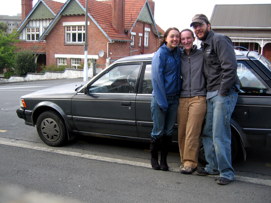
First off, we bought a car. Her name is Lu and we bought her from Elizabeth who will be leaving for the States in a few month and wanted her car to "continue the adventure." She's an '83 Nissan Bluebird wagon. Her name comes from her model (bLUebird) and her license plate number is "LU 234."


We had a bit of a late night on Monday night hanging out with Elizabeth and some other friends we met at the hostel so our start was much later than we had planned. We got out of Dunedin around 11:00 am. From there we drove south to the city of Invercargill [1]. If you've seen the movie "The World's Fastest Indian" Invercargill is where the main character is from.


Invercargill also has a Tuataratarium (that's what I call it). Tuatara are these amazingly weird reptiles that only live in NZ and are very very rare. I strongly recommend you read the wikipedia article on them here: "http://en.wikipedia.org/wiki/Tuatara". These things are amazing. The picture is of one named Henry who is AT LEAST 125 years old. They don't actually know when he was born but he's very old.
Invercargill is basically the bottom of the island so from there we dove north. We did several things along the road including running into the freezing ocean (I didn't think it was going to be so deep!), checking out a hundred year old suspension bridge, and doing a bit of caving where we saw our first glow worms. We bought the station wagon so that we could fold down the seats in the back and camp right there in the car so that night we parked along the shore of Lake Manapouri [2], constructed some curtains that go up with velcro, and slept the night.

Day 2 - Wednesday, October 11th
The back seats folded down were very uncomfortable and it turns out we parked on the side of a logging truck road so we woke up at about 6:30 am. We continued north and came to a town called Te Anau where they have a "Wildlife center." We knew we wanted to stop here because they have several of the very rare Takahes. These flightless birds were thought extinct until they were rediscovered in 1948. Again, I strongly recommend the wikipedia article here: "http://en.wikipedia.org/wiki/Takahe".


The Takahe in the picture is named Bruce and they don't know how old he is. The sign just said "very old." As soon as we walked up to his enclosure he trotted right over and said hello. He watched us for a bit and then he started making these guttural noises and then he turned around and spread out his wings to display for us. Carrie thinks he fancied her but I think he was after me. At this center there were lots of examples of NZ wildlife (which means birds).
From Te Anau we decided to take some extra time and drive all the way up to Milford Sound. This is a good time to interject some comments about NZ roads. In NZ they don't really have large highways and they certainly don't have anything similar to US Interstates. Instead, all of the major roads are one lane each way and very windy (as in meandering). There also aren't many of them. Basically there is one highway on the East coast of the island and one on the West coast of the island and a few that connect them. On these roads (especially on the West coast where it is very mountainous) there are many bridges. On the South island these bridges are mostly one lane. That means that there are a lot of yield signs. If any of these bridges were washed away or damaged in anyway it would mean that you could simply no longer get to the West coast. It great! All of the routes in NZ are the scenic route. Ok, back to our trip.
Milford Sound [3] in a long way out of the way. To get there you have to drive about three hours North up a very windy road and then (because this is NZ) to leave you have to come all the way back South again before you can continue your Northerly direction. We had been told by people before we left that we should not miss Milford Sound so we went for it. It is, we have learned, one of the biggest tourist destinations in NZ. It is sort of akin to the Grand Canyon in the States. Everyone goes there. We had already resigned ourselves to doing some things that were very touristy and in some cases things are so popular with good reason. Milford Sound was incredible! First of all the drive there was unbelievable. Gorgeous mountains and beautiful waterfalls. On our way we stopped a lot to see all of the amazing places on the way. We took a hike out to Humbolt Falls (pictured below). If you look closely at the photo you can see that the falls are actually three tiers. I wish we could have gotten closer.
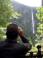

After the falls we visited the "Mirror Lakes" which were beautiful, Lake Gunn with was immaculate, and a Chasm which I can't even begin to describe, sorry.


The views as we drove along were amazing. For a large section of the drive you are not allowed to stop the car because on avalanche danger but there was one spot designated as a "safe stopping spot" and we stopped there to take some pictures. Waiting there for us were these two Keas. The Kea is another NZ native bird. It is like a large green parrot with a very hooked beak. They are known to be troublemakers. They have no fear of people and they are very intelligent which makes them very curious. Apparently these two keas have figured out that this one spot is the only place where people stop so they just hang out there all day waiting for the next tourist. We had not stopped for more than a minute and they were already on top of Lu chewing on windshield wipers and the roof rack. Apparently they are known for letting air out of tires because they like to play with the air valves. It was pretty funny.


In order to get to Milford you have to go through a tunnel through the mountain for about a kilometer. It is the sketchiest tunnel I've ever seen. The walls are rough cut and the whole tunnel is lit with what seem to be 10 Watt bulbs. They did paint the rock walls white so that you can kind of see them but it was pretty scary going through.


Once we arrived at Milford Sound we realized that to really see it we were going to have to take some sort of boat out onto the water. Milford Sound is actually not a sound we learned. It is a fjord. The town of Milford is very small and sits at the inland-most end of the fjord. We took a tour boat cruise to go see the rest of it. Basically you have to imagine cliffs standing some 1200 meters high rising directly from the water. The cliffs actually continue straight down under water and the fjord is 300 meters deep. 300 meters! The water is perfectly black because it is so deep. Along these sheer cliffs are hundreds of waterfall. Every year at Milford they get about 6 meters of rain so everyone we had talked to warned us that it would rain while we were there. Actually it was misty and a bit wet but it was comfortable. When it rains there are even more waterfalls. There are only about 6 or 7 that are permanent but it was wet enough for us to se many falls. The highest falls in the sound (everyone calls it a sound so I'm just going to do that too) is Bowen falls which stands 520 feet high. For comparison Niagara Falls are only 170 feet high. The boat took us the length of Milford all the way to the Tasman Sea and back. Along the way we spotted a Fjordland crested penguin in the water. That was exciting.
After our trip we took off back South and retraced our steps to Te Anau where we could turn inland and head North again. Queenstown [4] is a very touristy town on our way where there is a very young crowd of bungy jumpers and skydivers and such. It is very easy to spend a lot of money in Queenstown so we decided to just drive on through. We spent the night at the side of Moke lake [5] in a campground this time. We learned that we can stay at Department of Conservation campgrounds and not be disturbed by logging trucks. Rusty and Wal suggested Moke lake and we can't thank them enough. It was beautiful.

Day 3 - Thursday, October 12th
We slept a bit better that night because there were no trucks but we still got up at 8:00 am because the back of Lu just isn't that comfortable (yet). We went and did a geocache at a place called Bob's Cove. It was very nice we were actually the first to find the cache which is exciting in the geocaching world. We drove back through Queenstown and we visited a cool old Chinese gold miners settlement in a small town called Arrowtown. From there we went further North until we stopped at a place called "Puzzling World." I don't remember how we heard about if but it is this really cool place where they have all of these examples of optical illusions and puzzles and they have a huge maze that you can go through. The paths in the maze are about 1.5 kilometers in total and it was a real challenge. We used a theory I had been dying to try out since middleschool for just such a situation. If you just keep your hand on one wall the whole time you can guarantee not to repeat anything and you will find your way out. It worked great.
After the geocache we were headed out of town when we passed the local "Resource Recovery Center". Now, we don't really have these in the US but we should! Rusty and Wal taught us the benefits of the RRC. Basically what it is is a store at the dump. They collect all of the things that people throw away that are still good and sell them very cheap to people who need them. Its like a thrift store that is stocked by dumpster divers. They have these stores all over NZ. So we swung by the RRC and bought a perfect foam mattress. it doesn't smell and it was clean and beautiful we got it for $5 and threw it in the back of Lu. We've never slept so well. Best $5 ever spent.
The whole trip we have been doing geocaches because they are free and they bring us to cool places. I'm not mentioning all of them because there were a ton but this next one really deserves a picture so I'm putting it up. This place was called the Blue Pools and you wouldn't believe how blue this water was unless I posted a picture. It was amazing! And the water was perfectly clear so you could see all of the huge trout just swimming away in there. Beautiful!
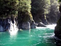

That night our camera battery died so we stopped at a local pub and plugged it in while drinking a beer. Speights! its great stuff, if you can get it anywhere in the States let me know because I'll be very excited. After our battery was mostly full we went to our next campsite at Lake Paringa. It was another DOC campsite and, with our new mattress, we decided we could sleep in a bit. It was great!

Day 4 - Friday, October 13th
Friday the 13th! We slept great and the day started off very well with a visit to Fox glacier. The sun was shining (which we had heard was very rare on the West coast) and the glacier was incredible. I'd never seen a glacier. I never really knew what to expect. I guess I figured it would just be a bunch of white snow or something. I just didn't know. It turns out that glaciers are really beautiful. Not to mention huge! In the picture below you can see me standing in the bottom right corner and where I'm standing I'm still about 100 meters from the base of the ice. It was really really big.


After that we went for a hike around this lake where, on a clear day, you can see a perfect view of Mt. Cook (the largest mountain in NZ) reflected in the water. Odds are good that if you've ever seen a picture of Mt. Cook it was taken there. It was not a clear day so we just hiked around the lake, grabbed a geocache, and set off. From there we went to visit the other glacier nearby (Fraz Joseph Glacier) but by this time the fabled West coast rain had set in and the weather made us grumpy.
We continued North trying a few geocaches and basically moped because of the weather. There was one cool geocache on an abandoned railway bridge where we had to walk out onto the bridge to retrieve it. It was a bit dodgy but easy enough that it was fun. That evening we visited a glow worm dell in Hokitika. Glow worms are really cool. There is the spot where you can walk in and all of the walls of this forested dell are covered in glow worms. I think fireflies are cooler but we'd never seen glow worms like this and it was beautiful. That night we stayed at another DOC campsite nearby.

Day 5 - Saturday, October 14th
It was rainy and nasty still when we woke up. We continued North until we got to Greymouth which is a pretty big city. The day before we had a realization that libraries are good places to stop to charge the computer, the iPod and the camera so we stopped at the Greymouth library. While we were in there Carrie noticed a sign on the street that said that a restaurant nearby had free wireless. We decided that it would help our mood if we had some good food and checked our email etc. It was a Persian restaurant and I had some Spana Kopita which was pretty good but not as good (or plentiful) as Mom's.
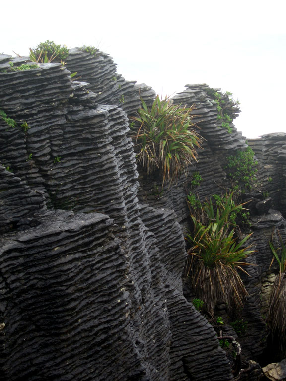
After our relaxed time in Greymouth we drove to these very cool rock formations at Punakaiki. The rocks were formed in such a way that the wear of the ocean of thousands of years has made them look like very tall very crunchy stacks of pancakes. They were dramatic and cool looking and I'm sure that if the weather had been better we would have found them even more so.


After several more geocaches and a bunch of driving we finally departed the West coast and were ecstatic to see the Sun again. We spent the night at another DOC campground where there was a cool geocache at the end of an old railway tunnel.

Day 6 - Sunday, October 15th
When we woke up we couldn't believe that the dreary weather had followed us over the mountains. It was rainy and gross again. So we got back in the car and continued to drive North until we got to Nelson which was a beautiful city with great weather. In Nelson we went to an art gallery which sucked. I don't know about you all but I'm really sick of art where the message is "look art can be anything." I feel like that point was made a long time ago when Marcel Duchamp hung a urinal on a wall and called it art. This whole gallery was filled with stuff that was still saying the same thing. I guess I'm old fashioned but I like art that takes talent. There were two exceptions. One was a woman who had made these small Chinese style pieces depicting several mythical creatures and scenes. They looked like they were beautifully done pen on paper but when you read the description it said that they were actually needlepoint done with the artist's hair. It was really amazing. There was such detail that you really could not tell they were sewn. The other exception was a woman who did these combination pieces of painting and metal work. They were mostly square paintings connected by metal pieces. It is hard to describe but they were really beautiful. Carrie and I agreed that if we had money we would have purchased one.
From there we went East to Picton which is where the ferry across the Cook Straight departs. Our ferry was at 8:15 am on Monday so we had plenty of time Sunday afternoon to just mill about Picton. We ended up taking a twenty cent ride on a model train to support the local model engineer's club and went to our camp site at a about 3:00 pm. I read for the afternoon and Carrie spent some time drawing (more on that in another post).

Day 7 - Monday, October 16th


We had to get up quite early in order to drive form our campground to the ferry and all three of us (Carrie, Me, and Lu) were unhappy about it. But we pulled through and arrived at the ferry about an hour early. We were the second car on the boat. The ferry was a very large boat. Probably the largest boat I have ever been on. It was fun. The trip takes about 3 hours and the ferry is very comfortable. It is like a cruise ship. The weather could not have been better for our crossing. Beautiful blue skies, not too windy and calm seas. We spent the whole trip out on the deck watching for whales. No luck though. We did see quite a few albatross though and one fur seal. That was exciting.
The ferry dropped us off in Wellington (now we're on the North Island). We had decided that a hot meal would be nice so we went in search of good food. Before long we ended up at an Indian restaurant (mmmm). After lunch we had an amazing set of coincidences that turned disaster into triumph. When we returned to our car we had a ticket in the wiper for $200! We couldn't believe it! The ticket said that we did not have current registration displayed. As we were trying to figure out what we had done wrong (it turns out we had our registration covered by another piece of official paperwork and didn't know we had done anything wrong) a man who just happened to have parked right in from of us right then just happened to ask us what was wrong. He told us that we should just go into the office of traffic violations (where he just happened to be going and directly in front of which we just happened to have parked) and tell them the situation. So we did, we proved that we did in fact have registration and the lady said we were all set. No trouble. It was a bit of an emotional rollercoaster.
From Wellington to Tokaroa (where we are now) is about 500 or 600 kilometers so we spent the rest of the day just driving North to get here on Monday night. We had great weather the whole way up except that it rained in the desert while we drove through (go figure).

Anyway, that was our trip. I'm going to let Carrie post sometime later about what we are doing here in Tokaroa but we could not have had a better trip really and we are excited to get started working with bats.

Congratulations, you've made it to the end.

Matt

p.s. We've signed up for dial-up here where we are so we will be in email contact pretty much.

[1] Invercargill 46°24'18.98"S, 168°21'14.69"E
[2] First Camp 45°25'19.31"S, 167°42'47.26"E
[3] Milford Sound 44°39'7.20"S, 167°55'35.99"E
[4] Queenstown 45° 2'21.97"S, 168°42'29.23"E
[5] Moke Lake 45° 0'1.97"S, 168°34'9.67"E

Tuesday, September 12, 2006

Pure Danger


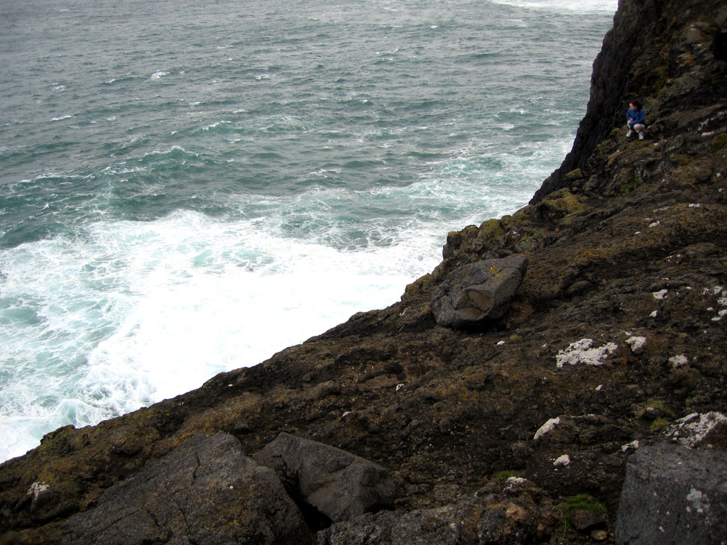
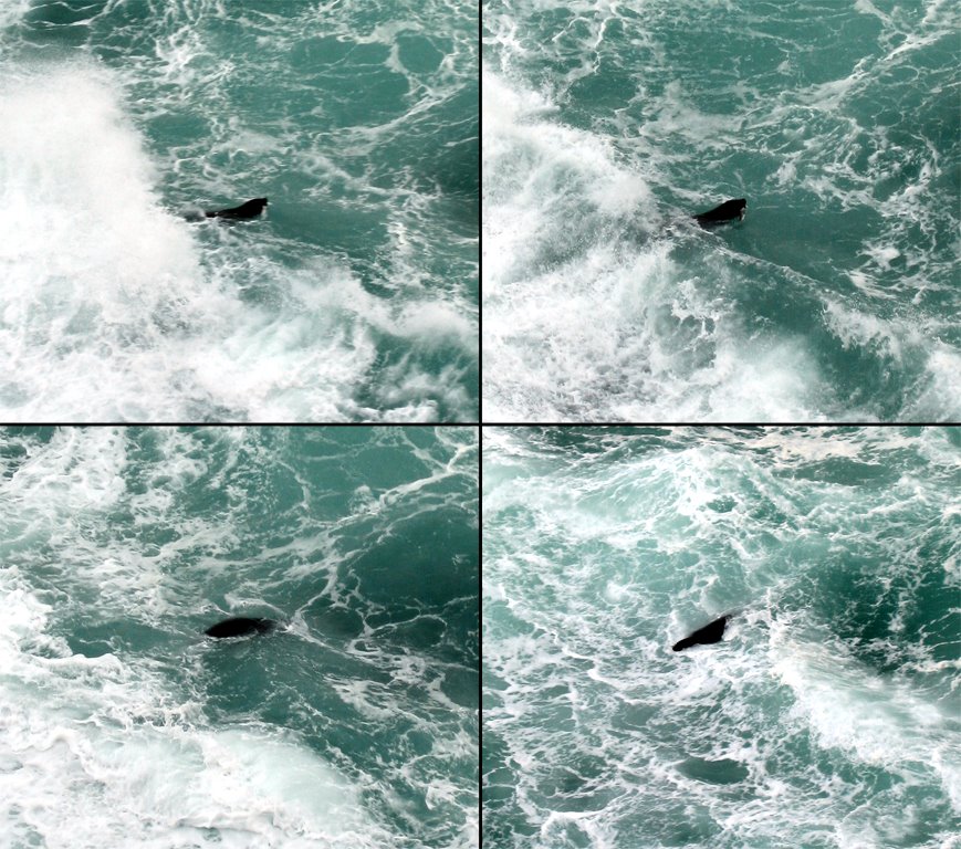
Sunday was our first day in Dunedin. I saw Elizabeth for the first time since we parted ways two years ago in the Irkutsk airport at the end of the Tahoe Baikal Summer Exchange progam. Being the adventurous people we are, we decided to tackle a challenging Geocache on the Otago peninsula near the city of Dunedin. The title of the cache was "Vertigo Extreme" and was rated 5/5 for terrain difficulty. We followed a sheep path along the edge of a cliff about 100 m above the ocean, then down a steep but manageable grassy slope to a ledge about 30 m (100 feet) over the rough surf below. Watching the waves churn from such great heights was vertigo-inducing! We searched in vain for the cache, but did see a rainbow, numerous seabirds, and a sea lion hunting fish! Check out the pictures Matt took of it! Once it even came up with two fish in its mouth, but it lost one when it tried to turn them around in its mouth.


The rainbow was a sign of the rain coming in from the Pacific, so we had to leave our sea lion friend to make it back up the slope before we got too wet. Even so the rain and wind pelted the left sides of our bodies as we made our way back to the car. This is another great example of a place we never would have found if it weren't for Geocaching.


For those of you keeping track at home this geocache was at 45°52'43.09"S, 170°44'19.64"E.

Carrie

Archive