Disclaimer! Disclaimer! Disclaimer!
This is going to be a long post.
So, we had an amazing drive up from the South to the North and I intend to tell you all about it here. Cheers to those of you who make it to the end. I recommend clicking on the pictures to make them larger. They are better bigger.
Day 1 - Tuesday, October 10th
First off, we bought a car. Her name is Lu and we bought her from Elizabeth who will be leaving for the States in a few month and wanted her car to "continue the adventure." She's an '83 Nissan Bluebird wagon. Her name comes from her model (bLUebird) and her license plate number is "LU 234."

We had a bit of a late night on Monday night hanging out with Elizabeth and some other friends we met at the hostel so our start was much later than we had planned. We got out of Dunedin around 11:00 am. From there we drove south to the city of Invercargill [1]. If you've seen the movie "The World's Fastest Indian" Invercargill is where the main character is from.

Invercargill also has a Tuataratarium (that's what I call it). Tuatara are these amazingly weird reptiles that only live in NZ and are very very rare. I strongly recommend you read the wikipedia article on them here: "http://en.wikipedia.org/wiki/Tuatara". These things are amazing. The picture is of one named Henry who is AT LEAST 125 years old. They don't actually know when he was born but he's very old.
Invercargill is basically the bottom of the island so from there we dove north. We did several things along the road including running into the freezing ocean (I didn't think it was going to be so deep!), checking out a hundred year old suspension bridge, and doing a bit of caving where we saw our first glow worms. We bought the station wagon so that we could fold down the seats in the back and camp right there in the car so that night we parked along the shore of Lake Manapouri [2], constructed some curtains that go up with velcro, and slept the night.
Day 2 - Wednesday, October 11th
The back seats folded down were very uncomfortable and it turns out we parked on the side of a logging truck road so we woke up at about 6:30 am. We continued north and came to a town called Te Anau where they have a "Wildlife center." We knew we wanted to stop here because they have several of the very rare Takahes. These flightless birds were thought extinct until they were rediscovered in 1948. Again, I strongly recommend the wikipedia article here: "http://en.wikipedia.org/wiki/Takahe".

The Takahe in the picture is named Bruce and they don't know how old he is. The sign just said "very old." As soon as we walked up to his enclosure he trotted right over and said hello. He watched us for a bit and then he started making these guttural noises and then he turned around and spread out his wings to display for us. Carrie thinks he fancied her but I think he was after me. At this center there were lots of examples of NZ wildlife (which means birds).
From Te Anau we decided to take some extra time and drive all the way up to Milford Sound. This is a good time to interject some comments about NZ roads. In NZ they don't really have large highways and they certainly don't have anything similar to US Interstates. Instead, all of the major roads are one lane each way and very windy (as in meandering). There also aren't many of them. Basically there is one highway on the East coast of the island and one on the West coast of the island and a few that connect them. On these roads (especially on the West coast where it is very mountainous) there are many bridges. On the South island these bridges are mostly one lane. That means that there are a lot of yield signs. If any of these bridges were washed away or damaged in anyway it would mean that you could simply no longer get to the West coast. It great! All of the routes in NZ are the scenic route. Ok, back to our trip.
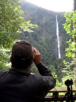
Milford Sound [3] in a long way out of the way. To get there you have to drive about three hours North up a very windy road and then (because this is NZ) to leave you have to come all the way back South again before you can continue your Northerly direction. We had been told by people before we left that we should not miss Milford Sound so we went for it. It is, we have learned, one of the biggest tourist destinations in NZ. It is sort of akin to the Grand Canyon in the States. Everyone goes there. We had already resigned ourselves to doing some things that were very touristy and in some cases things are so popular with good reason. Milford Sound was incredible! First of all the drive there was unbelievable. Gorgeous mountains and beautiful waterfalls. On our way we stopped a lot to see all of the amazing places on the way. We took a hike out to Humbolt Falls (pictured below). If you look closely at the photo you can see that the falls are actually three tiers. I wish we could have gotten closer.
After the falls we visited the "Mirror Lakes" which were beautiful, Lake Gunn with was immaculate, and a Chasm which I can't even begin to describe, sorry.

The views as we drove along were amazing. For a large section of the drive you are not allowed to stop the car because on avalanche danger but there was one spot designated as a "safe stopping spot" and we stopped there to take some pictures. Waiting there for us were these two Keas. The Kea is another NZ native bird. It is like a large green parrot with a very hooked beak. They are known to be troublemakers. They have no fear of people and they are very intelligent which makes them very curious. Apparently these two keas have figured out that this one spot is the only place where people stop so they just hang out there all day waiting for the next tourist. We had not stopped for more than a minute and they were already on top of Lu chewing on windshield wipers and the roof rack. Apparently they are known for letting air out of tires because they like to play with the air valves. It was pretty funny.

In order to get to Milford you have to go through a tunnel through the mountain for about a kilometer. It is the sketchiest tunnel I've ever seen. The walls are rough cut and the whole tunnel is lit with what seem to be 10 Watt bulbs. They did paint the rock walls white so that you can kind of see them but it was pretty scary going through.

Once we arrived at Milford Sound we realized that to really see it we were going to have to take some sort of boat out onto the water. Milford Sound is actually not a sound we learned. It is a fjord. The town of Milford is very small and sits at the inland-most end of the fjord. We took a tour boat cruise to go see the rest of it. Basically you have to imagine cliffs standing some 1200 meters high rising directly from the water. The cliffs actually continue straight down under water and the fjord is 300 meters deep. 300 meters! The water is perfectly black because it is so deep. Along these sheer cliffs are hundreds of waterfall. Every year at Milford they get about 6 meters of rain so everyone we had talked to warned us that it would rain while we were there. Actually it was misty and a bit wet but it was comfortable. When it rains there are even more waterfalls. There are only about 6 or 7 that are permanent but it was wet enough for us to se many falls. The highest falls in the sound (everyone calls it a sound so I'm just going to do that too) is Bowen falls which stands 520 feet high. For comparison Niagara Falls are only 170 feet high. The boat took us the length of Milford all the way to the Tasman Sea and back. Along the way we spotted a Fjordland crested penguin in the water. That was exciting.
After our trip we took off back South and retraced our steps to Te Anau where we could turn inland and head North again. Queenstown [4] is a very touristy town on our way where there is a very young crowd of bungy jumpers and skydivers and such. It is very easy to spend a lot of money in Queenstown so we decided to just drive on through. We spent the night at the side of Moke lake [5] in a campground this time. We learned that we can stay at Department of Conservation campgrounds and not be disturbed by logging trucks. Rusty and Wal suggested Moke lake and we can't thank them enough. It was beautiful.
Day 3 - Thursday, October 12th
We slept a bit better that night because there were no trucks but we still got up at 8:00 am because the back of Lu just isn't that comfortable (yet). We went and did a geocache at a place called Bob's Cove. It was very nice we were actually the first to find the cache which is exciting in the geocaching world. We drove back through Queenstown and we visited a cool old Chinese gold miners settlement in a small town called Arrowtown. From there we went further North until we stopped at a place called "Puzzling World." I don't remember how we heard about if but it is this really cool place where they have all of these examples of optical illusions and puzzles and they have a huge maze that you can go through. The paths in the maze are about 1.5 kilometers in total and it was a real challenge. We used a theory I had been dying to try out since middleschool for just such a situation. If you just keep your hand on one wall the whole time you can guarantee not to repeat anything and you will find your way out. It worked great.
After the geocache we were headed out of town when we passed the local "Resource Recovery Center". Now, we don't really have these in the US but we should! Rusty and Wal taught us the benefits of the RRC. Basically what it is is a store at the dump. They collect all of the things that people throw away that are still good and sell them very cheap to people who need them. Its like a thrift store that is stocked by dumpster divers. They have these stores all over NZ. So we swung by the RRC and bought a perfect foam mattress. it doesn't smell and it was clean and beautiful we got it for $5 and threw it in the back of Lu. We've never slept so well. Best $5 ever spent.
The whole trip we have been doing geocaches because they are free and they bring us to cool places. I'm not mentioning all of them because there were a ton but this next one really deserves a picture so I'm putting it up. This place was called the Blue Pools and you wouldn't believe how blue this water was unless I posted a picture. It was amazing! And the water was perfectly clear so you could see all of the huge trout just swimming away in there. Beautiful!
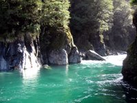
That night our camera battery died so we stopped at a local pub and plugged it in while drinking a beer. Speights! its great stuff, if you can get it anywhere in the States let me know because I'll be very excited. After our battery was mostly full we went to our next campsite at Lake Paringa. It was another DOC campsite and, with our new mattress, we decided we could sleep in a bit. It was great!
Day 4 - Friday, October 13th
Friday the 13th! We slept great and the day started off very well with a visit to Fox glacier. The sun was shining (which we had heard was very rare on the West coast) and the glacier was incredible. I'd never seen a glacier. I never really knew what to expect. I guess I figured it would just be a bunch of white snow or something. I just didn't know. It turns out that glaciers are really beautiful. Not to mention huge! In the picture below you can see me standing in the bottom right corner and where I'm standing I'm still about 100 meters from the base of the ice. It was really really big.

After that we went for a hike around this lake where, on a clear day, you can see a perfect view of Mt. Cook (the largest mountain in NZ) reflected in the water. Odds are good that if you've ever seen a picture of Mt. Cook it was taken there. It was not a clear day so we just hiked around the lake, grabbed a geocache, and set off. From there we went to visit the other glacier nearby (Fraz Joseph Glacier) but by this time the fabled West coast rain had set in and the weather made us grumpy.
We continued North trying a few geocaches and basically moped because of the weather. There was one cool geocache on an abandoned railway bridge where we had to walk out onto the bridge to retrieve it. It was a bit dodgy but easy enough that it was fun. That evening we visited a glow worm dell in Hokitika. Glow worms are really cool. There is the spot where you can walk in and all of the walls of this forested dell are covered in glow worms. I think fireflies are cooler but we'd never seen glow worms like this and it was beautiful. That night we stayed at another DOC campsite nearby.
Day 5 - Saturday, October 14th
It was rainy and nasty still when we woke up. We continued North until we got to Greymouth which is a pretty big city. The day before we had a realization that libraries are good places to stop to charge the computer, the iPod and the camera so we stopped at the Greymouth library. While we were in there Carrie noticed a sign on the street that said that a restaurant nearby had free wireless. We decided that it would help our mood if we had some good food and checked our email etc. It was a Persian restaurant and I had some Spana Kopita which was pretty good but not as good (or plentiful) as Mom's.
After our relaxed time in Greymouth we drove to these very cool rock formations at Punakaiki. The rocks were formed in such a way that the wear of the ocean of thousands of years has made them look like very tall very crunchy stacks of pancakes. They were dramatic and cool looking and I'm sure that if the weather had been better we would have found them even more so.

After several more geocaches and a bunch of driving we finally departed the West coast and were ecstatic to see the Sun again. We spent the night at another DOC campground where there was a cool geocache at the end of an old railway tunnel.
Day 6 - Sunday, October 15th
When we woke up we couldn't believe that the dreary weather had followed us over the mountains. It was rainy and gross again. So we got back in the car and continued to drive North until we got to Nelson which was a beautiful city with great weather. In Nelson we went to an art gallery which sucked. I don't know about you all but I'm really sick of art where the message is "look art can be anything." I feel like that point was made a long time ago when Marcel Duchamp hung a urinal on a wall and called it art. This whole gallery was filled with stuff that was still saying the same thing. I guess I'm old fashioned but I like art that takes talent. There were two exceptions. One was a woman who had made these small Chinese style pieces depicting several mythical creatures and scenes. They looked like they were beautifully done pen on paper but when you read the description it said that they were actually needlepoint done with the artist's hair. It was really amazing. There was such detail that you really could not tell they were sewn. The other exception was a woman who did these combination pieces of painting and metal work. They were mostly square paintings connected by metal pieces. It is hard to describe but they were really beautiful. Carrie and I agreed that if we had money we would have purchased one.
From there we went East to Picton which is where the ferry across the Cook Straight departs. Our ferry was at 8:15 am on Monday so we had plenty of time Sunday afternoon to just mill about Picton. We ended up taking a twenty cent ride on a model train to support the local model engineer's club and went to our camp site at a about 3:00 pm. I read for the afternoon and Carrie spent some time drawing (more on that in another post).
Day 7 - Monday, October 16th

We had to get up quite early in order to drive form our campground to the ferry and all three of us (Carrie, Me, and Lu) were unhappy about it. But we pulled through and arrived at the ferry about an hour early. We were the second car on the boat. The ferry was a very large boat. Probably the largest boat I have ever been on. It was fun. The trip takes about 3 hours and the ferry is very comfortable. It is like a cruise ship. The weather could not have been better for our crossing. Beautiful blue skies, not too windy and calm seas. We spent the whole trip out on the deck watching for whales. No luck though. We did see quite a few albatross though and one fur seal. That was exciting.
The ferry dropped us off in Wellington (now we're on the North Island). We had decided that a hot meal would be nice so we went in search of good food. Before long we ended up at an Indian restaurant (mmmm). After lunch we had an amazing set of coincidences that turned disaster into triumph. When we returned to our car we had a ticket in the wiper for $200! We couldn't believe it! The ticket said that we did not have current registration displayed. As we were trying to figure out what we had done wrong (it turns out we had our registration covered by another piece of official paperwork and didn't know we had done anything wrong) a man who just happened to have parked right in from of us right then just happened to ask us what was wrong. He told us that we should just go into the office of traffic violations (where he just happened to be going and directly in front of which we just happened to have parked) and tell them the situation. So we did, we proved that we did in fact have registration and the lady said we were all set. No trouble. It was a bit of an emotional rollercoaster.
From Wellington to Tokaroa (where we are now) is about 500 or 600 kilometers so we spent the rest of the day just driving North to get here on Monday night. We had great weather the whole way up except that it rained in the desert while we drove through (go figure).
Anyway, that was our trip. I'm going to let Carrie post sometime later about what we are doing here in Tokaroa but we could not have had a better trip really and we are excited to get started working with bats.
Congratulations, you've made it to the end.
Matt
p.s. We've signed up for dial-up here where we are so we will be in email contact pretty much.
[1] Invercargill 46°24'18.98"S, 168°21'14.69"E
[2] First Camp 45°25'19.31"S, 167°42'47.26"E
[3] Milford Sound 44°39'7.20"S, 167°55'35.99"E
[4] Queenstown 45° 2'21.97"S, 168°42'29.23"E
[5] Moke Lake 45° 0'1.97"S, 168°34'9.67"E

